Sinaproc Bad weather alert
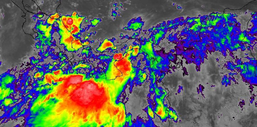
The National Civil Protection System (Sinaproc) reported that significant rainy events are expected in the coming days.
the electricity Transmission Company (Etesa) predicts that the movement of tropical wave number 35 towards the Panamanian national territory, , will be interacting with the Intertropical Convergence Zone and low pressures, favoring the formation of storms and bad weather.
The Sinaproc warns the maritime sector before the arrival of a swell to the Pacific coasts, generating strong waves along the coast. Waves with heights from one to three meters and periodicity varying between 14 to 20 seconds are expected. It will be under surveillance by the deep sea and with high tides in the Panamanian Pacific until Tuesday, September 14.
The areas under surveillance with wave heights up to 2.5 meters are: Gulf and Bay of Panama, Los Santos, Gulf of Chiriquí, and South of Veraguas., Sinaproc warned of possible coastal and beach floods, especially during high tides. They recommend the possible suspension of activities.